How Batavia’s Canals Changed Indigenous Settlement Patterns

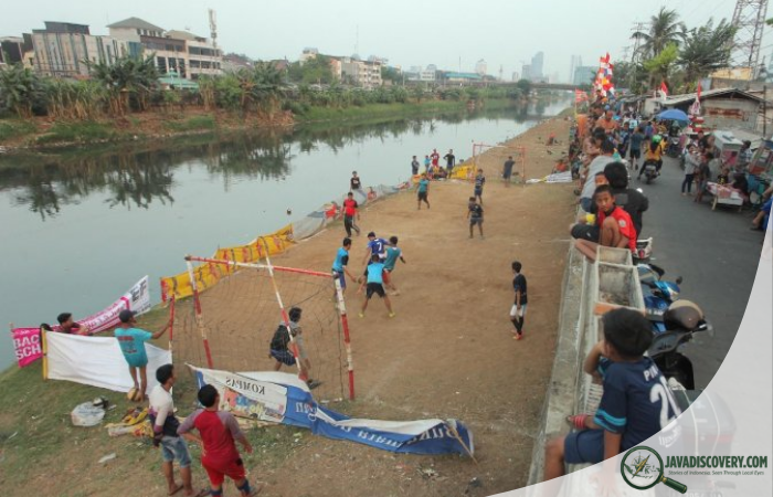
javadiscovery.com – At low tide, the muddy edges of Jakarta’s old canals reveal fragments of brick, pottery, and bone. The water moves slowly, carrying plastic bottles and the reflections of colonial facades whose white paint has long surrendered to mildew. Motorbikes buzz across nearby bridges. Vendors call out their prices in Betawi dialect. It is easy to see the canals as relics of a distant Dutch past. Yet when Batavia was carved into the swampy northern coast of Java in the seventeenth century, its canals did more than shape a colonial city. They reshaped the lives, movements, and settlement patterns of indigenous communities far beyond its fortified walls.
A City Imposed on Water
When the Dutch East India Company established Batavia in 1619 on the ruins of Jayakarta, they envisioned a tropical Amsterdam. Engineers set to work cutting canals across marshland, redirecting rivers, and constructing dikes to control the tidal flow from the Java Sea. The Ciliwung River, once meandering through mangroves and kampung clusters, was straightened and segmented into geometric lines.
The design reflected European urban ideals. Canals would serve as transportation arteries, defensive moats, and drainage systems. Warehouses lined the banks. Merchant houses faced the water, their narrow facades mirroring those in the Netherlands. From above, Batavia appeared orderly, rational, modern.
But beneath this grid lay an ecological and social transformation that rippled outward into surrounding indigenous settlements.
Displacement from the Riverbanks
Before Dutch intervention, settlements along the north coast of Java were fluid and adaptive. Kampung communities oriented themselves toward rivers for fishing, bathing, and irrigation. Houses were often raised on stilts, built from bamboo and thatch, designed to accommodate seasonal floods.
The canal system disrupted this rhythm. Large sections of riverbank were appropriated for fortified walls, warehouses, and elite residences. Indigenous residents were gradually pushed outward, away from the fortified core. Access to waterways became restricted, regulated by colonial authority.
Communities that once lived adjacent to the Ciliwung found themselves relocated to peripheral areas. Some moved east toward what is now Kampung Melayu. Others settled southward, beyond the strict surveillance of the colonial center. The spatial hierarchy of Batavia began to reflect a racialized order: Europeans within the fortified city, Chinese communities in designated quarters, and indigenous populations largely relegated to outer kampung.
Water as Control
The canals were not merely infrastructure. They were instruments of governance. By controlling water flow, colonial authorities controlled sanitation, trade routes, and movement. Bridges became checkpoints. Boats required permits. Nighttime access could be restricted.
This reconfiguration altered indigenous economic patterns. Fishermen who once launched small boats freely along natural inlets faced new regulations. Farmers whose fields depended on seasonal flooding encountered altered water levels due to canal redirection and dike construction.
In time, stagnant canal water contributed to outbreaks of malaria and other diseases. The European population suffered heavily, but indigenous laborers, confined to poorly drained outskirts, bore disproportionate consequences. As mortality rates rose in the walled city during the eighteenth century, many Europeans relocated to higher southern districts. Indigenous communities, however, remained concentrated in low-lying zones shaped by the altered hydrology.
Emergence of Peripheral Kampung
As Batavia expanded, new kampung emerged along the city’s margins. These settlements were not random clusters but adaptive responses to imposed geography. Residents built homes along secondary waterways created by canal overflow. Informal paths connected neighborhoods beyond official road grids.
Over generations, these kampung developed distinct identities. Betawi culture, often described as Jakarta’s indigenous identity, formed within this crucible of displacement and interaction. Language blended Malay, Sundanese, Javanese, Arabic, and Dutch influences. Culinary traditions incorporated ingredients traded through colonial networks.
The canals, intended as tools of European order, inadvertently fostered hybrid communities outside their boundaries. Indigenous settlement patterns became more nucleated in some areas, more dispersed in others, depending on access to water and employment within the colonial economy.
Environmental Consequences
Transforming wetlands into canal-lined streets required draining marshes and cutting mangroves. This ecological shift reduced natural flood absorption. During heavy monsoon rains, water overflowed into surrounding kampung, where drainage infrastructure lagged behind the European core.
Indigenous builders adapted by raising foundations higher, reinforcing bamboo walls, and constructing makeshift footbridges. Settlement patterns became vertically responsive. Elevated walkways threaded between houses during flood season, reshaping social interaction and daily routines.
Water, once a shared resource, became stratified. Clean water access varied dramatically depending on proximity to colonial facilities. Wells in outer settlements were vulnerable to contamination from stagnant canals upstream.
Labor, Mobility, and Market Space
The canal system also reoriented economic life. Markets shifted toward canal-adjacent hubs where goods arrived by boat. Indigenous traders migrated closer to these nodes, establishing temporary stalls that gradually solidified into permanent neighborhoods.
Dockyards and warehouses required labor. Indigenous workers commuted daily from peripheral kampung into the colonial center. This pattern of daily migration between residential outskirts and commercial core would persist long after the Dutch era.
Over time, roads supplemented canals as primary transport routes. Yet the spatial divisions created in the seventeenth and eighteenth centuries continued to influence where communities clustered. Former peripheral zones evolved into densely populated districts, their origins tied to displacement from canal-dominated Batavia.
From Batavia to Jakarta
In the nineteenth century, colonial planners acknowledged the health hazards of the original canal grid. The administrative center gradually shifted southward to Weltevreden, where broader boulevards and open spaces replaced cramped waterways. The old city declined, its canals silting and stagnating.
Indigenous settlements, however, remained anchored in the patterns established centuries earlier. Kampung networks expanded organically, often without formal planning. The legacy of canal-imposed segregation lingered in land ownership structures and neighborhood demographics.
When Indonesia declared independence in 1945 and Batavia became Jakarta, the canals were no longer symbols of foreign authority alone. They were embedded features of a complex urban fabric. Yet flooding, congestion, and uneven development continued to trace back to the original manipulation of water.
Echoes in the Present Landscape
Today, in Kota Tua, tourists photograph colonial facades while children fish in murky canal water. Restoration projects seek to revive historical charm. Meanwhile, in surrounding kampung, residents still adapt to seasonal floods intensified by subsidence and climate change.
The settlement patterns shaped by seventeenth-century engineering decisions remain visible. Dense neighborhoods cluster along waterways, their labyrinthine alleys defying the neat grid envisioned by Dutch planners. Elevated thresholds and improvised drainage channels reflect centuries of adaptation.
Urban historians note that infrastructure decisions rarely remain neutral. Batavia’s canals were designed to replicate a European city in tropical terrain. In doing so, they displaced, redirected, and reshaped indigenous habitation.
Water as Memory
As dusk settles over Jakarta’s old town, the canals darken to deep green. The call to prayer echoes between colonial warehouses now converted into cafes and museums. A fisherman casts his line from a crumbling embankment. Nearby, children balance along a narrow ledge, their laughter skipping across the water’s surface.
Few pause to consider how this geometry of water altered where their ancestors built homes, planted gardens, and raised families. Yet the imprint is there, etched into land titles, street names, and the organic sprawl of kampung life.
Batavia’s canals were conceived as instruments of trade and control. They succeeded in reshaping a landscape. But they also generated unintended social formations, fostering resilience and hybrid identity in the spaces beyond their ordered banks.
In the end, water proved both tool and teacher. It redirected not only ships and commerce, but human settlement itself. And in the slow current of Jakarta’s canals, history continues to flow, carrying with it the memory of a city imposed upon a river and the communities that learned to live around it.