Volcanic Soil Farmers of Merapi Fertile Earth Risk Agriculture

javadiscovery.com – Standing tall on the border between the Special Region of Yogyakarta and Central Java, Mount Merapi (2,910 meters)—whose name translates to “Mountain of Fire”—is widely recognized as one of the most active and volatile volcanoes on Earth. Its frequent, explosive eruptions unleash devastating pyroclastic flows (*wedhus gembel*), lahars, and thick volcanic ash clouds that periodically reshape the surrounding landscape. Yet, despite living directly under the constant shadow of catastrophic hazard, the high-altitude slopes of Merapi are among the most densely populated agricultural regions in Southeast Asia. For generations, hundreds of thousands of Javanese farmers have chosen to construct their homes and cultivate their fields high inside the Red Zone (*Kawasan Rawan Bencana*). This choice is not born of ignorance or stubbornness, but of a profound, calculated symbiosis with the volcano’s unmatched ecological gift: extraordinarily fertile volcanic soil.
Understanding the volcanic soil farmers of Merapi requires exploring the intersection of soil chemistry, high-yield agriculture, ancestral risk perception, and spiritual cosmology.
The Chemistry of Renewal: Why Merapi Soil is Unmatched
While an eruption brings immediate destruction, the volcanic ash and pyroclastic debris deposited by Merapi are rich in unweathered primary minerals. Over relatively short geological timeframes, these deposits transform into some of the most fertile soils on the planet—known as Andisols or volcanic ash soils:
- Mineral Wealth: Merapi’s tephra contains abundant concentrations of essential plant nutrients, including potassium, phosphorus, calcium, magnesium, and trace elements like iron and zinc. Unlike old, leached lowland tropical soils, fresh volcanic material continually rejuvenates the topsoil.
- Exceptional Water Retention: Andisols possess a highly porous, sponge-like structure with high organic matter accumulation. This unique soil texture retains moisture during dry spells while maintaining excellent drainage during heavy monsoon rains, preventing root rot.
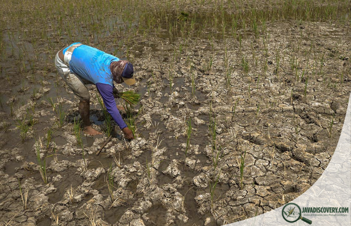
- Multi-Cropping Abundance: The extraordinary fertility allows farmers on Merapi’s southern and eastern flanks (in Sleman, Boyolali, and Klaten) to harvest up to three or four crop cycles a year without heavy reliance on synthetic fertilizers. High-value crops like salak fruit (*Salacca zalacca* or Snakefruit), chili, scallions, tobacco, and dairy cattle forage thrive effortlessly.
Living with Wedhus Gembel: Local Risk Perception and Adaptation
For the farming communities of Merapi, the volcano is not viewed as an enemy or an unmitigated threat, but as a living provider—affectionately addressed as Eyang Merapi (Grandfather Merapi). Over centuries, villagers have developed sophisticated adaptation mechanisms to balance daily survival against volcanic risk:
- Early Warning and Indigenous Indicators: Long before modern seismographs register activity, local farmers detect impending eruptions by observing subtle natural signals—such as wild animals descending from upper forests, sudden changes in spring temperatures, or unusual subterranean rumbles.
- Agile Rebound and Replanting: When pyroclastic flows or ashfalls blanket fields, crops are destroyed in the short term. However, once the ash cools and is plowed into the underlying soil alongside organic compost, subsequent planting seasons yield record-breaking harvests. Farmers view temporary displacement as a routine price for long-term agricultural prosperity.
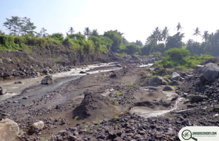
- Volcanic Sand and Stone Mining: In addition to farming, Merapi’s river valleys (such as Kali Gendol and Kali Woro) deposit millions of cubic meters of premium-grade volcanic sand and building stone during eruptions, fueling a lucrative local aggregate mining industry that supplements farm income.
Cosmology and Sacred Geography: The Kraton Connection
The decision to remain on Merapi’s slopes is deeply reinforced by Javanese spiritual philosophy and the sacred axis of the Yogyakarta Sultanate (*Kraton Yogyakarta*):
- The Sacred North-South Axis: In classical Javanese cosmology, Merapi sits at the northern pole of an invisible spiritual line connecting the volcano, the Sultan’s palace (*Kraton*), and the Indian Ocean to the south. The volcano represents the cosmic source of life, masculine energy, and terrestrial power.
- Labuhan Rituals: Every year, the Sultan of Yogyakarta sends royal emissaries to perform the *Labuhan Merapi* ritual on the mountain slopes, offering ceremonial garments, incense, and prayers to seek harmony with the spirit realm of Merapi and ensure agricultural safety for all of Central Java.
- Juru Kunci (The Spiritual Gatekeeper): Spiritual leaders, historically exemplified by the late Mbah Maridjan, serve as essential cultural intermediaries. Their traditional wisdom provides moral grounding and spiritual resilience for farming communities facing the existential uncertainty of living beside an active crater.
Preserving Life and Livelihood on the Edge of Fire
Today, modern disaster management agencies (*BPBD*) work in close coordination with local village evacuation teams to improve early warning systems, construct hazard shelters, and map evacuation routes without dismantling the socio-economic fabric of the mountain villages.
The volcanic soil farmers of Merapi remain an inspiring testament to human resilience—a community that has mastered the delicate art of living alongside one of the earth’s most formidable natural forces, turning volcanic risk into a bountiful, enduring way of life.