Why Ancient Malang Became a Center of East Java History

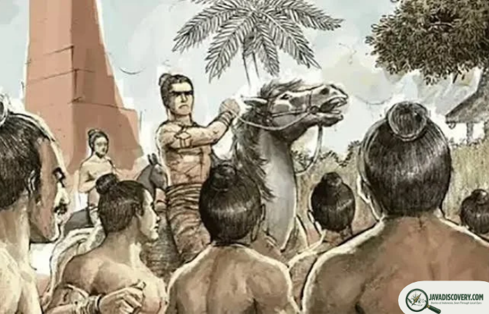
Long before Malang became known for its cool climate, university life, colonial boulevards, and mountain views, the landscape around it was already part of an important chapter in East Java’s history.
Across the valleys, villages, and foothills surrounding modern Malang are traces of societies that existed more than a thousand years ago. Inscriptions, temples, sacred sites, and archaeological remains reveal a landscape connected to early kingdoms and changing religious traditions.
Ancient Malang was not simply important because a kingdom happened to rise there. Its significance was also shaped by geography. The region offered fertile volcanic soils, abundant water, productive agricultural land, and access to routes connecting the interior of East Java with other important areas.
Two historical periods are particularly important when reading the ancient history of Malang: the early polity associated with Kanjuruhan and the later rise of Singhasari, or Tumapel. Between and around these periods, the region became part of a much wider political and cultural landscape that eventually contributed to the history of Majapahit.
Malang Before the Modern City
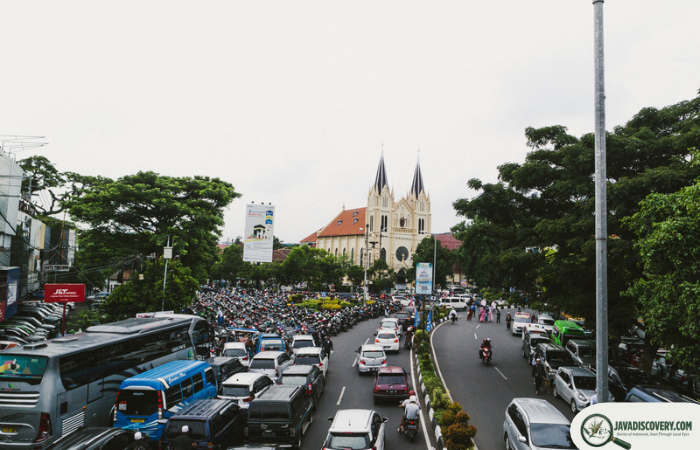
The word “Malang” today immediately suggests a modern city surrounded by mountains. Ancient history, however, requires a different map.
The historical landscape was not defined by the boundaries of today’s Kota Malang. Important archaeological sites are spread across what is now Malang City and Malang Regency, including areas around Dinoyo, Dau, Tumpang, Singosari, and other parts of the surrounding highlands.
This distinction matters because political territories in ancient Java did not necessarily correspond to modern administrative borders. When historians discuss ancient Malang, they are often referring to a broader cultural and geographical region rather than the city as it exists today.
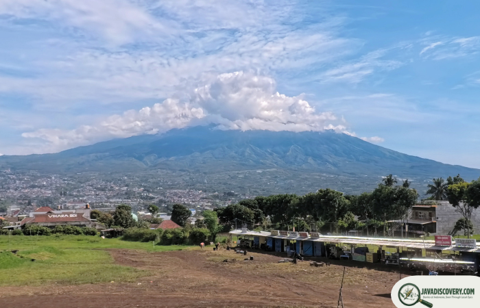
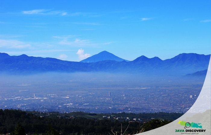
The physical landscape helps explain why this area attracted settlement. Malang lies within a highland basin surrounded by volcanic mountains. Rivers and streams cross the region, while volcanic soils created favorable conditions for agriculture.
These were valuable resources in a pre-industrial society. Food production supported permanent settlements, while water was essential not only for farming but also for religious practices and daily life.
The Earliest Written Clues From Kanjuruhan
One of the most important pieces of evidence for ancient Malang is the Dinoyo Inscription, dated to 760 CE. The inscription provides evidence for a political community associated with Kanjuruhan and records religious activity involving a sacred image and temple establishment.
The inscription is particularly valuable because it gives historians a glimpse into East Java during the eighth century, a period for which archaeological and written evidence remains relatively limited.
It mentions a ruler named Liswa and refers to a predecessor named Dewasingha. The text also describes the establishment or restoration of a sacred religious complex associated with the deity Agastya and the worship of Putikeswara.
The connection between the Dinoyo Inscription and Candi Badut has long been discussed by archaeologists and historians. Many scholars have associated the temple with the religious and political world described in the inscription, although the exact chronology and relationship between the two pieces of evidence have been debated. :contentReference[oaicite:0]{index=0}
The Dinoyo Inscription and the Kanjuruhan Question
Kanjuruhan is sometimes described as an ancient kingdom centered in the Malang region. That description is useful, but it should not be treated as if the exact borders and political structure of Kanjuruhan are fully known.
The inscription provides firm evidence that a political authority existed in the region during the eighth century. What remains more difficult to establish is the precise extent of its territory and how it was organized in relation to neighboring powers.
This is one reason ancient Malang is so fascinating. The surviving evidence is substantial enough to reveal a sophisticated society, yet incomplete enough that archaeologists must reconstruct its history from inscriptions, architecture, landscape, and comparative evidence.
Candi Badut and the Religious Landscape
West of Malang, near Karangwidoro in Dau, stands Candi Badut, one of the most important early archaeological monuments in the region.
The temple is constructed primarily from andesite stone and has a square plan with a west-facing entrance. Inside the central chamber is a damaged lingga-yoni, while the temple complex also contains sculptural fragments and architectural remains.
The temple’s architecture and artistic style have made Candi Badut an important subject in discussions about the early development of temple architecture in Java. A recent archaeological study notes that the widely accepted interpretation places the temple among the early temples of Java, although alternative dating proposals have also been discussed. :contentReference[oaicite:1]{index=1}
The connection between Candi Badut and the Dinoyo Inscription is particularly significant because it brings together two different kinds of historical evidence: written records and physical remains.
Yet the relationship should not be presented as completely settled. Archaeological research has produced different interpretations concerning the dating of Badut and its precise relationship to the inscription. This uncertainty is not a weakness of the history; it is part of what makes archaeological research meaningful.
Why the Malang Landscape Was Valuable
The importance of ancient Malang cannot be separated from its geography.
Volcanic landscapes can be both dangerous and extraordinarily productive. Mountains surrounding the region periodically reshaped the environment, but volcanic materials also contributed to fertile soils that supported agriculture.
Water was equally important. Streams and rivers flowing through the highlands provided resources for settlements and agriculture. Sacred water sites also became part of the religious landscape, reflecting the close relationship between natural resources and spiritual life in ancient Java.
For an early political center, such an environment offered several advantages at once: agricultural production, access to water, habitable highlands, and connections to surrounding regions.
Malang’s position also made it possible to connect the highland interior with the wider network of East Java. Rather than imagining ancient kingdoms as isolated territories, it is more useful to see them as parts of a landscape of settlements, agricultural zones, religious centers, and political networks.
The Rise of Singhasari
Several centuries after the world recorded by the Dinoyo Inscription, the Malang region again became central to East Javanese political history.
This was the era of Singhasari, also known as Tumapel in historical sources. During the thirteenth century, the political center associated with Singhasari emerged in the area around present-day Singosari, north of modern Malang.
The rise of Singhasari transformed the historical importance of the region. Malang was no longer simply associated with an early eighth-century political community. It became part of the story of a powerful East Javanese kingdom whose rulers would later be closely connected with the expansion of political influence across the archipelago.
The archaeological remains around Singosari provide some of the clearest physical evidence of this later period.
Candi Kidal and Royal Memory
One of these monuments is Candi Kidal in Tumpang, Malang Regency. The temple is associated with the Singhasari period and is traditionally identified as a memorial temple for Anusapati, one of the kingdom’s rulers.
Candi Kidal is especially notable for its reliefs depicting Garudeya, the story of Garuda. The reliefs are among the temple’s most distinctive artistic features and demonstrate how religious stories were incorporated into monumental architecture.
The temple is also described by Indonesia’s cultural heritage authorities as a Shivaite temple built of andesite and associated with the royal memorial tradition of Singhasari. :contentReference[oaicite:2]{index=2}
Standing among modern agricultural fields, Candi Kidal offers an unusual experience of historical geography. The monument is not isolated from the landscape around it. Its position makes sense when viewed as part of a wider network of ancient settlements and sacred places in the Malang region.
Candi Jago and the World of Singhasari
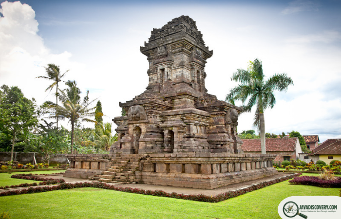
Further north lies Candi Jago, another major monument associated with Singhasari.
The temple was known as Jajaghu and is connected with King Wisnuwardhana. According to the Nagarakretagama, the monument was associated with the king’s posthumous commemoration. The cultural heritage authorities place its construction in the period between approximately 1268 and 1280 CE. :contentReference[oaicite:3]{index=3}
Candi Jago is important not only because of its royal association but also because its reliefs preserve a complex visual world. Hindu and Buddhist ideas appear within the artistic program, reflecting the religious environment of medieval East Java.
Such monuments remind us that ancient Malang was not merely a political center. It was also a place where religious ideas, artistic traditions, royal memory, and local society intersected.
Candi Singosari and the Memory of a Kingdom
Perhaps the most famous monument connected with this period is Candi Singosari.
Located in present-day Singosari, the temple stands close to the historical heartland associated with the Singhasari kingdom. The monument is generally dated to the early fourteenth century and is connected with the period following the kingdom’s political transformation. It is officially recognized as a national-level cultural heritage structure. :contentReference[oaicite:4]{index=4}
Its location is especially revealing. The temple is not in the center of today’s Malang city. Instead, it lies in the northern part of the wider Malang region, showing why modern urban boundaries can obscure the geography of ancient East Java.
The Singosari area contains other archaeological remains as well. Excavations and discoveries around the region have revealed traces of ancient structures and settlement activity, although individual discoveries require careful archaeological interpretation rather than automatic identification as royal buildings.
For visitors today, the landscape can appear deceptively ordinary. Roads, houses, farms, schools, and modern businesses surround archaeological remains. Yet beneath this modern landscape are layers of settlement that extend back many centuries.
Malang Was More Than a Royal Capital
It is tempting to tell ancient Malang’s story entirely through kings and kingdoms. But that approach leaves out much of what actually made the region important.
Kingdoms depended on communities.
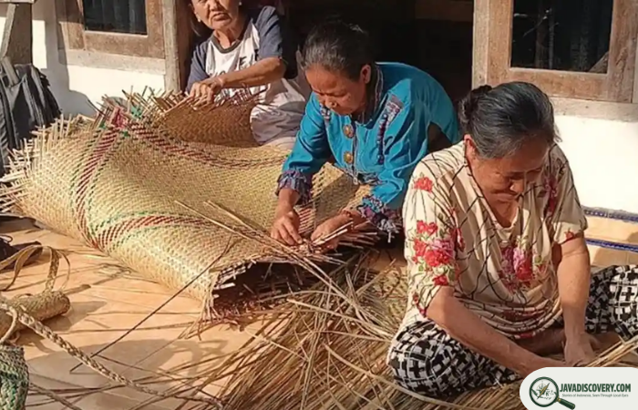
Farmers produced food. Artisans shaped stone and metal. Religious specialists maintained temples and rituals. Builders organized labor. Traders moved goods. Local communities occupied settlements around the centers of political authority.
Archaeological evidence from Malang increasingly encourages a broader view of the ancient landscape. Discoveries of structures, architectural fragments, settlement remains, and religious sites suggest that the region was a lived environment rather than simply the location of royal monuments.
This is especially important when interpreting places such as Singosari. The royal center was supported by a much larger landscape of agriculture, settlements, sacred sites, and transportation routes.
From Singhasari Toward Majapahit
The political history of East Java did not end with Singhasari.
In the late thirteenth century, political changes associated with the fall of Singhasari contributed to the emergence of Majapahit. The historical relationship between the two kingdoms is well established, but the transition should not be imagined as an instant replacement in which one landscape simply disappeared and another appeared.
People, religious traditions, political institutions, artistic styles, and places continued to exist through periods of political change.
Malang therefore remained part of the broader historical geography of East Java even as political centers shifted. Some monuments were connected to earlier royal traditions, while later developments introduced new architectural and cultural forms.
The archaeological landscape around Malang preserves fragments of these overlapping periods. This makes the region valuable for understanding not one kingdom but the longer evolution of East Javanese civilization.
A Landscape Written in Stone and Water
One of the most striking aspects of ancient Malang is how closely history is tied to the natural environment.
The mountains remain on the horizon. Rivers still cross the valleys. Agricultural land continues to occupy parts of the same broad landscape that supported earlier communities.
What has changed is the scale and appearance of human settlement.
A temple that once stood within a carefully organized sacred environment may now sit beside a village road. A site once associated with royal authority may now be surrounded by houses. Ancient stones may appear almost ordinary until their inscriptions, carvings, and architectural details reveal their age.
In this sense, Malang’s ancient history is not locked inside museums. It remains embedded in the landscape.
What Ancient Malang Still Reveals Today
Ancient Malang became important through a combination of geography, agriculture, religion, political power, and connections with the wider world of East Java.
The Dinoyo Inscription shows that a political and religious community existed in the region by the eighth century. Candi Badut provides an architectural window into the early religious landscape. Centuries later, the rise of Singhasari placed the Malang region at the heart of one of East Java’s most significant medieval kingdoms.
Candi Kidal, Candi Jago, and Candi Singosari preserve different chapters of that later history. Together, they demonstrate that the region was repeatedly reshaped by changing political powers and religious traditions.
But perhaps the most important lesson is that ancient Malang should not be understood simply as a forgotten capital.
It was a landscape where people farmed volcanic soil, followed rivers, built sacred places, remembered their rulers, practiced religious traditions, and developed communities that survived long after individual kingdoms changed.
Today, modern Malang can be experienced as a lively highland city. Look beyond its contemporary streets, however, and another Malang begins to emerge: a much older landscape of temples, inscriptions, water, agriculture, and mountains that helps explain why this corner of East Java has mattered for more than a millennium.
Its history is not preserved in a single monument. It is scattered across the landscape, waiting to be read.
Writer: Sari Mahendra