Ancient Harbor of Bergota Searching Semarang Lost Maritime Gateway

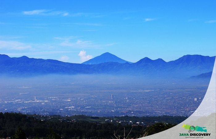
javadiscovery.com – To stand today atop the quiet, elevated slopes of Bergota—site of Semarang’s central cemetery hill—is to gaze over a dense, sprawling modern urban landscape of highways, high-rises, and coastal residential sprawl. Yet, beneath the asphalt and modern foundations of Central Semarang lies a remarkable geological and historical secret. Over a millennium ago, during the golden age of the Mataram Kingdom (8th–10th centuries CE), the coastline of northern Java cut dozens of kilometers farther inland than it does today. Bergota was not an inland hill, but a bustling coastal promontory and deep-water natural harbor (*Pragota*). Serving as the principal maritime gateway for Hindu-Buddhist dynasties trading with China, India, and the wider maritime Silk Road, this ancient port linked international sea routes directly to the sacred volcanic temples of the Javanese interior.
Uncovering the lost harbor of Bergota requires peeling back centuries of heavy alluvial siltation, geological transformation, and urban expansion to reveal the maritime cradle of Central Java.
Pragota: The Natural Gateway of Ancient Mataram
In the 8th and 9th centuries, under the patronage of the Sanjaya and Sailendra dynasties—the master builders of Borobudur and Prambanan—Central Java experienced an unprecedented artistic and economic renaissance. While the political and agricultural heartlands lay nestled in the fertile volcanic valleys of Kedu and Kewu, maritime trade was the economic engine that connected the kingdom to international merchant networks:
- The Deep-Water Estuary: Ancient *Pragota* occupied a strategic sheltered bay formed by the foothills of the northern Kendeng range. Protected from seasonal monsoon swells, the deep estuary allowed ocean-going Chinese junks, Indian dhows, and local Javanese outrigger vessels to anchor safely close to shore.
- The Riverine Highway: From Pragota, merchant barges navigated upstream along the ancient, un-silted channels of the Garang and Semarang rivers, carrying imported ceramics, silks, glass, and metals directly into interior trading posts at the foot of Mount Ungaran.
- Toponymic Clues: The name *Bergota* itself is a direct linguistic evolution of the ancient Javanese word *Pragota* (or *Pragoti*), recorded in early regional records as a major coastal landing site before silting forced maritime activity northward.
The Silting of the North Coast: A Harbor Swallowed by Land
The disappearance of Bergota as a maritime port is one of the most dramatic examples of environmental transformation along Java’s northern Pesisir. The process was driven by both natural geological forces and human activity in the volcanic highlands:
- Volcanic Ash and Erosion: Frequent eruptions from Mount Merapi and Mount Ungaran deposited millions of tons of loose volcanic ash into regional watersheds. Heavy tropical monsoon rains washed this sediment down river channels, depositing massive alluvial deltas along the coast.
- Rapid Coastal Accretion: Over several centuries, the shoreline advanced seaward at a rate of several meters per year. What was once a deep ocean bay gradually transformed into shallow mudflats, brackish mangrove swamps, and eventually dry, arable plain.
- Relocation of the Port: As Bergota became landlocked, the maritime center was forced to migrate northward. By the 15th and 16th centuries—during the era of the Islamic Kingdom of Demak and the early arrival of Chinese admiral Zedong (Cheng Ho)—the primary anchorage had moved to Simongan (site of the famous Sam Poo Kong temple), before shifting further north to modern Kota Lama and Tanjung Mas.
Archaeological Traces and Subterranean Discoveries
Because modern Semarang was built directly over this reclaimed landscape, physical evidence of ancient Bergota lies buried beneath layers of urban silt. However, accidental archaeological finds and geological core drilling continue to confirm the district’s maritime past:
- Subterranean Shipwreck Timber: Excavations and deep foundation works across central Semarang have occasionally uncovered ancient wooden ship planks, iron anchors, and clay ballast stones buried meters beneath dry land far inland from the current coastline.
- Ceramic Cargo Deposits: Heavy concentrations of Tang (618–907 CE) and Song Dynasty (960–1279 CE) Chinese celadon sherds, Middle Eastern glassware, and terracotta storage jars have been excavated surrounding the Bergota hill, confirming intensive long-distance maritime exchange.
- Geological Core Samples: Soil core samples taken across the lowland corridor between Bergota and Simongan reveal distinct layers of ancient marine shells, estuarine mud, and coastal salt deposits, offering undeniable physical proof of the ancient sea margin.
Legacy: Remembering Semarang’s Maritime Origins
The story of Bergota’s lost harbor is a powerful reminder that Java’s landscape is a dynamic, living entity shaped by the intimate interplay between volcanic mountains and the sea. Without the natural deep-water anchorage of ancient Pragota, the historical trade networks that financed Java’s classical monument-building era could never have flourished.
Today, as visitors walk near the historic hills of Bergota, looking out over a city that has marched kilometers out into the sea, they stand upon the forgotten shoreline where ancient merchants once stepped off the ocean into the heartland of Java.